
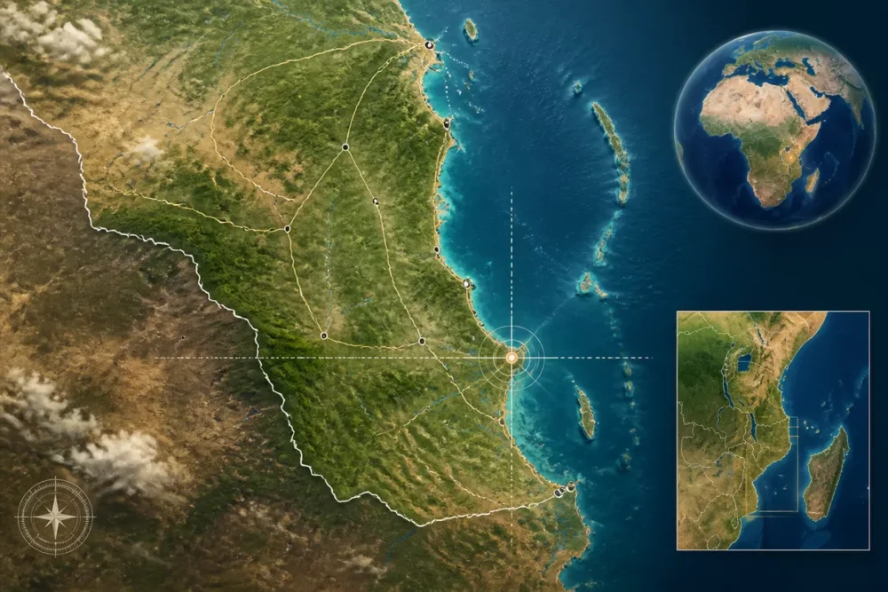
Map of Lindi in Tanzania: location, nearby towns, and access
Lindi is located on the southeast coast of Tanzania, along the Indian Ocean. The city is situated south of Dar es Salaam, north of Mtwara, and east of the border with Mozambique.
This map of Lindi distinguishes the city, the administrative region, and neighboring localities. You will also find the main roadways and a method to verify a route before traveling, especially when road conditions or mobile coverage may vary.
Table des matières
In Brief
- 📍 Lindi is a coastal city in southeastern Tanzania, on the Indian Ocean.
- 🧭 The city is located south of Dar es Salaam and north of Mtwara.
- 🗺️ Search for “Lindi, Tanzania” on a mapping service to display the city and its surroundings.
- 🚗 Road distances should be checked before departure, as they depend on the route and local conditions.
Where is Lindi located in Tanzania?
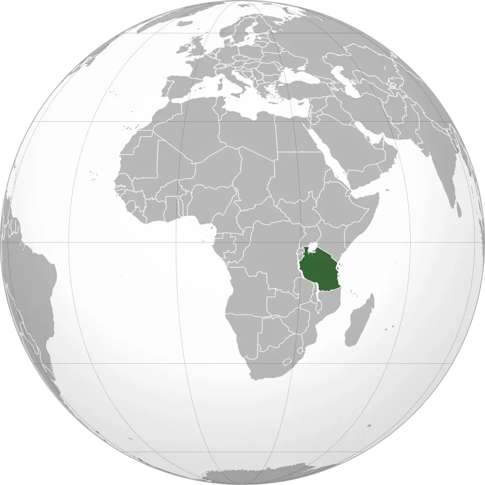
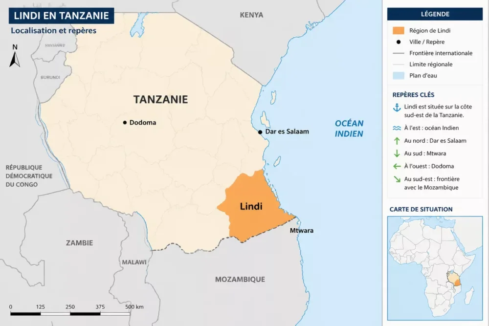
Lindi is a city in southeastern Tanzania, situated on the coast of the Indian Ocean. It belongs to the administrative region of Lindi and lies between Dar es Salaam to the north and Mtwara to the south. On a map of Tanzania, Lindi therefore appears in the southern coastal part of the country, relatively close to the border with Mozambique.
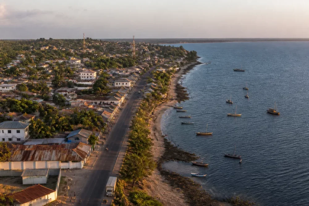
The shortest answer to the question “where is Lindi?” is as follows: Lindi is located on the southeastern coast of Tanzania, south of Dar es Salaam and north of Mtwara.
To locate the city precisely, search for “Lindi, Tanzania” on an updated map, then verify that the displayed point corresponds to the urban center or the desired address.
The national map helps understand Lindi’s general position, but it is not sufficient to prepare a route within neighborhoods or nearby localities. For a precise search, use the city name and a sufficiently close zoom level, then compare the proposed route with a second mapping source.
Do not confuse the city of Lindi with the Lindi region
The city of Lindi is a coastal urban area, while the Lindi region is a much larger administrative division of Tanzania. The region includes several districts and localities, whose maps may cover rural areas far from the urban center. This difference explains why a “Lindi map” search may display regional boundaries rather than a city plan.
The administrative region extends around the city and notably includes sectors associated with Lindi Municipal, Lindi District, Kilwa, Liwale, and Nachingwea. The divisions may be presented differently depending on the map’s date and the administrative level considered; therefore, boundaries must be checked on an official Tanzanian source or a dated cartographic database.
The city of Lindi on a detailed map
At the urban scale, useful landmarks are the center of Lindi, the waterfront, main roads, and facilities indicated by available mapping. Secondary information, such as some neighborhood boundaries or certain points of interest not recently verified, should be considered cautiously when preparing an actual trip.
- Urban center: starting point to search for an address or service.
- Coastline: geographical reference that helps understand the city’s orientation.
- Main roads: elements to check before choosing a road route.
- Facilities: hospitals, administrations, gas stations, or markets, according to the data visible on the map.
The Lindi region at the scale of Tanzania
At the regional scale, the map relates Lindi with Kilwa to the north, Mtwara to the south, and the inland territories of Liwale and Nachingwea. Administrative boundaries should not be confused with urban areas: a region may contain districts, municipalities, villages, and vast undeveloped spaces.
Lindi on the map of Tanzania: the main landmarks
Lindi faces the Indian Ocean, in the southern coastal strip of Tanzania. Dar es Salaam is to the north, Mtwara to the south, and Dodoma to the west, inland. The border with Mozambique lies further south, beyond the Mtwara area.
This position allows for distinguishing three main directions: heading north towards Dar es Salaam via the general coastal axis, going south towards Mtwara and continuing into southeastern Tanzania, or reaching the interior of the country via roads departing from the coast. Exact routes may vary depending on passable sections and updates to the mapping.
A national map answers the question “where is Lindi located in Tanzania?”, while a local map answers the question “how to reach a specific address?”.
The map of Tanzania thus provides the national context, but it does not allow for deducing travel time. A distance measured in a straight line ignores detours imposed by the road network, waterways, protected areas, and possible traffic restrictions.
Cities near Lindi and indicative distances
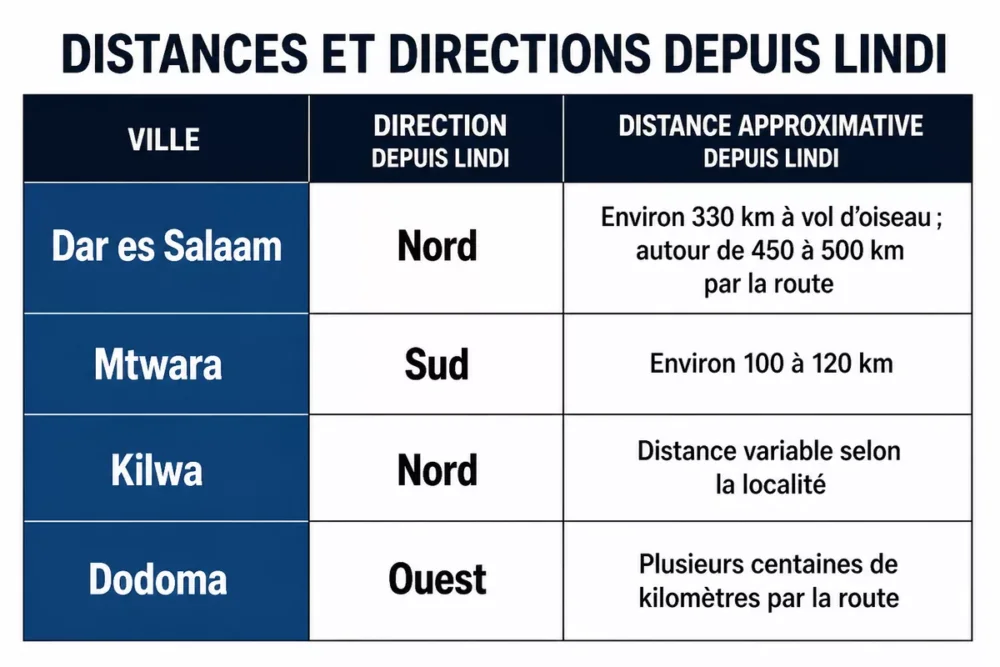
The distances below serve to read the map and compare general directions. They do not constitute a transport schedule: road distance depends on the chosen route, road conditions, construction, and traffic conditions at the time of departure.
| City or landmark | Direction from Lindi | Distance | Practical reading |
|---|---|---|---|
| Dar es Salaam | North | To be calculated according to departure and arrival points | Compare the direct measurement with the road itinerary before departure |
| Mtwara | South | To be calculated according to departure and arrival points | Major coastal landmark south of Lindi |
| Kilwa | North | To be calculated specifying the locality sought | The name “Kilwa” refers to several localities |
| Dodoma | West | To be calculated according to the chosen route | National landmark located inland in Tanzania |
Before traveling, calculate the route on an updated mapping service with the exact departure and arrival points. Road distance depends notably on the chosen route and local conditions.
Lindi and Dar es Salaam
Dar es Salaam is located north of Lindi, on the Tanzanian coast. The straight-line distance is shorter than the road distance, as a road does not necessarily follow a direct line and must adhere to the existing network.
To prepare a Lindi–Dar es Salaam connection, search separately for the departure city and the arrival address. Then check the proposed route, any itinerary changes, and the date of the available information, without deducing a reliable duration from the distance displayed alone.
Lindi and Mtwara
Mtwara is located south of Lindi, also in the southeastern coastal zone of Tanzania. The actual duration depends on the chosen route and its condition.
Bus schedules, private services, and travel conditions must be checked with operators or local authorities before departure. A map may indicate an axis, but it does not guarantee its passability or the availability of transport at a given time.
Kilwa and other local landmarks
Kilwa helps to read the coast located north of Lindi, but the name can refer to several localities or sectors. Kilwa Masoko and Kilwa Kivinje should therefore not be treated as a single point without specifying the location sought.
The localities of Liwale, Nachingwea, and Nyangao serve more as regional or inland landmarks. Their presence on a map of the Lindi region does not mean they are in the immediate vicinity of the urban center.
How to use the Lindi map to prepare a trip?
To prepare a trip to Lindi, start by identifying the correct geographic level: city, region, district, or locality. Then search for the exact name of the place, compare the straight-line distance with the road distance, and check practical information just before departure. This method limits confusion between similar place names.
- Locate the correct point: use “Lindi, Tanzania” and verify the displayed label.
- Choose the zoom level: a national view locates Lindi, while a closer view is used to search for a street or facility.
- Compare routes: examine the road distance, detours, and proposed secondary roads.
- Check recent information: look for roadworks, restrictions, schedules, and local conditions.
- Prepare an offline solution: download the useful area when mobile coverage may be limited.
An interactive map is convenient for searching a place, getting directions, and sharing a precise point. A static or downloaded map remains useful when the connection disappears, but it can quickly become outdated if a road is changed or temporarily impassable.
Finding a precise location around Lindi
Coordinates are particularly useful when a place name is misspelled or when a locality has a name similar to another. Verify that the displayed point is indeed in the coastal area of Lindi and not in another Tanzanian region.
The search must also take into account toponym variants. Lindi, Lindi District, Lindi Region, and a local address do not designate the same perimeter; the displayed result must therefore be read with its full administrative label.
Check a route before departure
The distance displayed by an application is not enough to evaluate a trip. At least check the map update date, the type of road, any restrictions, and the schedules published by the carrier when traveling by bus or with a local service.
For a trip to Lindi, the good practice is to consider the map as a preparation base, then confirm travel conditions with an updated local source.
- Do not confuse a straight-line distance with a road distance.
- Do not automatically choose the shortest route if a secondary road is less reliable.
- Do not assume that a schedule displayed online is still valid without operator confirmation.
- Keep the exact name of the locality and the coordinates of the arrival point.
Key takeaways
- 📍 Lindi is a coastal city located in southeastern Tanzania.
- 🗺️ The city of Lindi should not be confused with the administrative region of Lindi.
- 🧭 Dar es Salaam is to the north, Mtwara to the south, and Dodoma to the west.
- 🚗 Road distances must be checked before any departure.
- 📱 An offline map can be useful when mobile coverage is limited.
Frequently Asked Questions
Where is Lindi located in Tanzania?
Lindi is located in southeastern Tanzania, on the coast of the Indian Ocean. The city is situated south of Dar es Salaam and north of Mtwara, in the administrative region of Lindi.
Is Lindi located on the shore of the Indian Ocean?
Yes, the city of Lindi is a coastal city facing the Indian Ocean. The Lindi region is larger and also includes inland territories that are not directly on the seashore.
What is the distance between Lindi and Dar es Salaam?
The distance between Lindi and Dar es Salaam depends on the exact departure and arrival points as well as the chosen route. Check an updated map before departure to distinguish the straight-line distance from the road distance.
Are Lindi and Mtwara close?
Mtwara is located south of Lindi, on the same southeastern Tanzanian coastal front. The actual trip depends on the available road and traffic conditions.
What coordinates should be used to locate Lindi?
Search for “Lindi, Tanzania” on an updated mapping service, then verify that the chosen point corresponds to the urban center or the searched address.