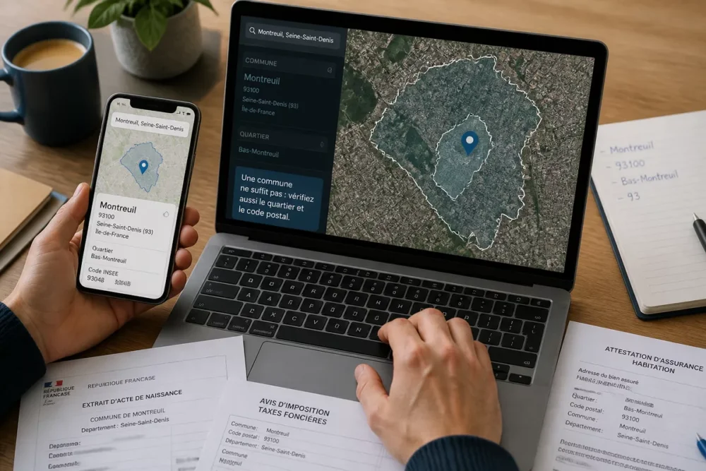
A city is not always enough to understand a place: in France, the unit that most often matters for procedures, services, and public data is the municipality. And when geolocation comes into play, you gain precision… provided you know how to read what it really shows.
The trap is simple: a city name can refer to a common usage, while the municipality, postal code, neighborhood, and GPS point each tell a different part of the story. Here, we lay the cards on the table to correctly link a city to its municipality and find useful local information without making mistakes.
Table des matières
In brief
📍 The municipality is the right basis to verify an address, a town hall, a local service, or an administrative competence.
🗺️ Geolocation is used to pinpoint an exact place, but it does not replace either the address or municipal boundaries.
🏘️ The word city is often broader and more common than the municipality; therefore, several clues must be cross-checked.
🔎 The right reflex is to check the name, postal code, GPS point, and public services before concluding.
How to link a city to its municipality?
The most reliable method is to start from the address, then cross-check the common name, postal code, map, and, if needed, the official municipal reference. In other words, do not stop at the word “city” displayed on a page or in a GPS: verify which municipality the place really belongs to.
This difference quickly matters. Two places can share a similar name, a station may be known under a broader name than the municipality that hosts it, and a neighborhood may seem autonomous while it depends on a single municipality. For local information, the right reflex is therefore to go from the concrete to the administrative, not the other way around.
To link a city to its municipality, start from the address name, then check the postal code, the exact point on the map, and the associated official municipality. Geolocation helps to locate the place, but only the municipality allows knowing which local authority and services it is attached to.
- Step 1: note the name displayed on the address or the place’s record.
- Step 2: check the postal code and the indicated municipality name.
- Step 3: compare with the map or GPS point to identify the exact neighborhood.
- Step 4: verify the useful services: town hall, schools, transport, collection, health.
What is the difference between city, municipality, and geolocation?
The short answer: the city is often a common term, the municipality is the reference administrative unit, and geolocation designates the exact position of a point. The three concepts sometimes overlap, but they are not used at the same time nor for the same need.
If you are looking for practical information — town hall hours, school district, waste collection, urban planning, parking, local services — the municipality is generally the right level to consult. The city, on the other hand, is more user-friendly; geolocation mainly serves to locate without ambiguity.
| Concept | What it refers to | Common mistake | Good practice |
|---|---|---|---|
| City | Common name of an urban area or a known hub | Always assuming it is equivalent to the municipality | Check if the name is common or administrative |
| Municipality | Local administrative base | Confusing it with a neighborhood or an urban area | Read the official municipality linked to the address |
| Geolocation | Precise position of a point on a map or GPS | Thinking that a GPS point is enough for all information | Cross-check the point with the address and the municipality |
| Neighborhood | Local subset, often non-administrative | Taking it for a full municipality | Identify the municipality it belongs to |
| Postal code | Useful postal marker, but not always exhaustive | Considering it as sufficient proof | Combine it with the municipality name |
The city catches the eye, but the municipality counts as soon as you need to verify a local service, an address, or an administrative boundary.
In practice, the best reading is always cross-checked. This is especially true if you compare two living areas, because the label “city” can mask very concrete differences in transport, budget, and services. On this subject, the article on medium-sized city or large metropolis helps distinguish the urban feeling from the real living environment.

A postal code helps to locate, but it is not enough to define a municipality nor to describe the services that depend on it.
Which local information should be verified first?
Once the municipality is identified, you need to get straight to the point: the useful local information is that which changes your daily life, your commute, or your procedures. For a resident, a visitor, or a future arrival, the most useful data are not the longest to read, but those that can be quickly verified and avoid a bad surprise.
- Town hall and public service: hours, reception, procedures, possible branch office.
- Transport: train station, bus, frequency, access time, connections.
- Facilities: school, daycare, middle school, media library, sports facility.
- Daily life: waste collection, parking, pedestrian zones, markets.
- Health and safety: pharmacy, doctor, emergencies, useful numbers, lighting, traffic.
The detail that changes everything is the scale. A municipality can be well served in the town center and much less so in its hamlets or peripheral neighborhoods. This is where geolocation becomes useful: it allows you to locate a service within a few streets, which is better than a simple city label. If you compare broader living environments, keep this other choice guide handy to arbitrate between density, budget, and commutes.

How to use geolocation without making mistakes?
Geolocation is very useful to avoid confusion between a city center, a neighborhood, and a neighboring municipality. But it is only useful if you know how to interpret it: a point on a map indicates a position, not necessarily the administrative entity that manages local services.
When comparing an address, a business, or a residential area, the right method is to check the exact point, then trace back to the municipality and official information. This is even more true for a sensitive or atypical area; even in very local searches, such as those conducted around the right municipalities, the good reflex is to cross-check the map, address, and administrative perimeter before concluding.
- Locate the exact point on the map or in the GPS.
- Read the municipality name displayed next to the address.
- Compare with the postal code and, if possible, the neighborhood name.
- Check the local services linked to this municipality.
- Validate the result with an official source or an institutional website.
In practice, geolocation mainly serves to clear up ambiguities. It does not replace the correct administrative form, reading a municipality file, or verifying with a town hall. It is a precision tool, not an absolute truth: when used well, it avoids errors related to street side, neighboring municipality, or misplaced entry point.
What pitfalls avoid errors in name, postal code, or neighborhood?
The biggest pitfall is to believe that a single clue is enough. Yet a city name can be shared, a postal code can cover several uses, and a neighborhood can be better known than the municipality itself. To read local information correctly, you must accept the idea that a place has several levels of interpretation.
- Similar name: two municipalities can look alike without sharing the same services.
- Misleading postal code: it guides, but does not always identify the municipality alone.
- Famous neighborhood: it can be very well known in everyday language without being administrative.
- Poorly used GPS point: it locates but does not explain the local affiliation.
A frequent mistake is to look for the “right city” when the real question is: what is the municipality of affiliation, and which local service depends on this municipality? As soon as a procedure, a journey, or a purchase depends on a precise perimeter, you must verify the finest available data, not the most visible.
The right reflex is simple: name, address, postal code, map, then local service. This small order changes many things, especially when comparing neighborhoods, bordering municipalities, or delegated municipalities. At this stage, geolocation becomes a filter, not a verdict.
To remember
📍 The municipality is the best reference for local services and procedures.
🧭 Geolocation specifies a point but does not replace the official address.
🏙️ The word city remains useful for everyday reading, not for verifying everything.
🔎 Cross-referencing map, postal code, and municipality avoids most location errors.
FAQ
Is a city and a municipality always the same thing?
Not necessarily. In everyday language, the two are often mixed up, but the municipality is the administrative reference unit. The city can refer to a broader use, an urban center, or a locally known area.
Is the postal code enough to identify a municipality?
No, it must be cross-checked with the municipality name and, if needed, the map. The postal code helps guide the search, but it does not alone indicate which local service applies to the address.
Is geolocation more reliable than an address?
It is more precise for locating an exact point, but it does not replace the official address. To understand useful local information, you must combine the GPS point with the municipality name and the administrative context.
Why can a neighborhood display different local information?
Because a neighborhood is not always an administrative entity. It can belong to the same municipality while having different access, transport, or services depending on its position in the city.
How to know which town hall to contact?
You must first check the affiliated municipality, then look for the corresponding town hall, or even a branch town hall. This is the most reliable way to avoid boundary errors when handling a local request.